
Congress took the first important step in regulating the Mississippi River and its tributaries by passing the Flood Control Act of 1928, which empowered the Army Corps of Engineers to study and alter the nation’s river systems—the Mississippi especially. The Army Corps would build infrastructure to corral and maneuver the river in order to control it.
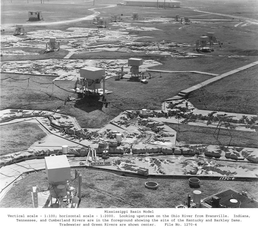
In 1943, the Army Corps began construction on a model that could test all 1.25 million square miles of the Mississippi River. It would be a three-dimensional map of nearly half of the continental United States, rendered to a 1/2000 horizontal scale, spanning more than 200 acres. It was so big that the only way to see all of it at once was from a four-story observation tower.
German prisoners-of-war were put to work building the model. It was fully operational by 1949.
A staff of six hundred engineers, technicians, and support staff would use the model to simulate past floods and to figure out what could be changed to achieve different results.
LINK (via: 99% Invisible)