
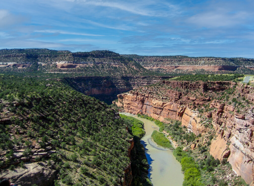
The Dolores River begins high among the San Miguel and Rico ranges, tumbling recklessly past long-defunct hardrock mines and flowing south-southwesterly to Dolores, Colorado. But irrigation and aridification have reduced it to a tepid trickle, and the banks have been thoroughly grazed, mined, and otherwise abused for well over a century. Thus, the lower 160-mile stretch has come to earn the melancholy moniker the Spanish friars gave it in the 1700s: El Rio de Nuestra Señora de Dolores, the River of Our Lady of Sorrows.
LINK (via High Country News)


Just got off yesterday. We did slickrock to bedrock in 3 days. Not many hazards other than really fast cold water, and no Eddies. The river is also super over grown with tammies, which made it hard to land pretty much anywhere. Most rapids were pretty washed out at 2800 cfs. The big concern was the low bridge shortly after the slick rock put-in. Turns out it wasn’t a problem at that level. Our party of 6 rafts did 30 miles on day one because we kept getting skunked on camps. A lot of parties out there thinking the same. Such a pretty section of desert river.
follow me on instagram @qamaristarks