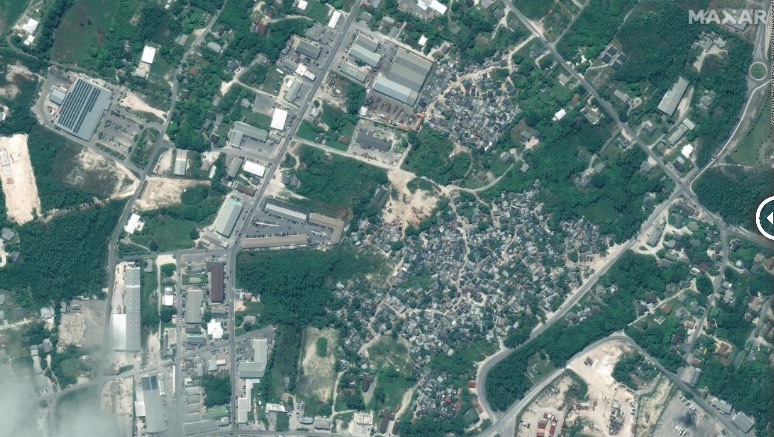
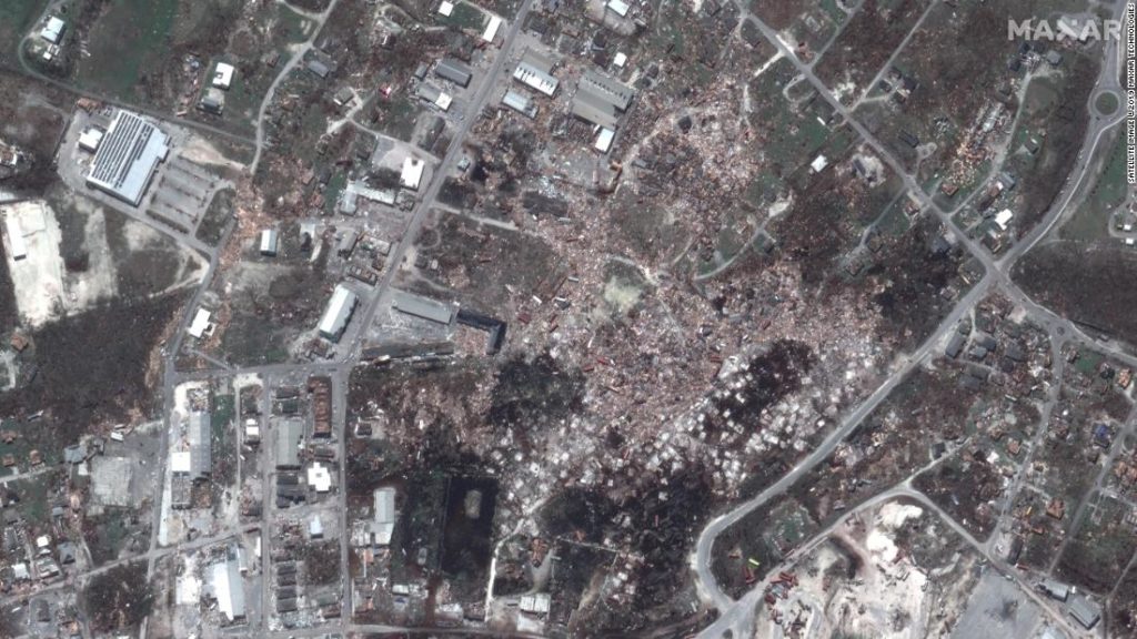
Satellite images from Maxar Technologies show the damage to several parts of Marsh Harbour on Great Abaco Island, which suffered a direct hit from the storm. The images from before the hurricane were taken on October 25, 2018, and the photos after Dorian hit were taken on September 5.
LINK (via: CNN)